April 26, 2013
Bill had some meetings in Eagle County on a Friday afternoon. I rode with him so we could do a quick one night camping trip afterwards. The FIRST trip of the 2013 season! After his meetings we headed North along the Colorado River Road from Dotsero. There are a few little primitive BLM campgrounds along the river between Dotsero and Bond. We stopped at the first one, Lyons Gulch, but after seeing a dead cow in the water in the river, decided we would head elsewhere since it smelled and our dog would be tempted by it all night. Plus it was right next to the road and there seemed to be more traffic than we anticipated.
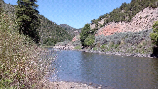
We went about 15 miles more north on the Colorado River Road (follows the CO River), to Pinball Point. The road goes from being paved to gravel a few miles after Lyons Gulch, you pass some big ranches and small little settlements. Pinball Point has river access, a large gravel parking area (good for parking your vehicles if you put in or take out your raft here), a vault toilet and one camping site. Luckily, no one was there so we checked it out and decided to stay. The site has a picnic table, a very impressive fire ring (I will go into that later) and a few decent spots to pitch a tent. Its elevated enough above the river that we really didnt worry about the water rising and taking over camp, but still low enough to here the ambient river noise at night.
 |
| Pinball Point Campsite |
 |
| The Impressive Fire Ring |
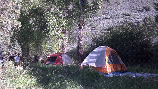
 We set up our tent, fished a bit and heated our dinner on our stove. Then as the sun was going down we made a fire, since it was supposed to get down into the low 30s that night. The fire ring looked almost brand new. It was very deep, double layered and had good air circulation but also was well insulated from the wind. Probably one of the most impressive fire rings I have seen in a campsite and to think we were on BLM land. Take note all national park, state park and forest service campgrounds!!! It did get quite chilly that night, but once we were in the tent I was cozy in my new Big Agnes sleeping bag that Bill got me. The only thing that was a negative was that the train tracks are right across the river along a cliff face which amplifies the sound of the passing trains all night! Oh well!
The next day we did a little cleaning of the trash we found around the site since there was quite a bit of it. Come on fellow campers, don't leave your trash around a campsite! We all go camping to enjoy the beauty and peace of nature, I don't want to know what type of beer you were drinking! After packing up camp, we headed further north along the road, we passed some nice vistas, another campground (Catamount), and the town of Burns. We took a short detour to check out the base of King Mountain, seems like a cool spot to explore some other time. Once we hit 131 we headed north to Steamboat.